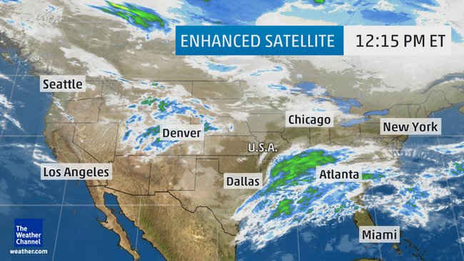
This photo indicates where rain, snow, freezing rain, and sleet are currently falling. Aside from last week’s snowstorms, the weather wild tend to be more mild across the East.
Today, in the South a cold front is expected to stall, with low pressure continuing over the Plains. Across the Southeast, severe storms are expected to hit. A stationary front is expected in the Southeast, that will extend southwestward. Moisture is expected to travel Northward from the Gulf of Mexico and mix with the frontal boundary. This will create rain and thunderstorms starting from Texas to the Southern Mid-Atlantic.
Showers and thunderstorms are expected throughout the week in Texas to the Southeast Coast. Snow showers are expected for the Rocky Mountains. Severe storms along the South are predicted, including a possible tornado From Tuesday until Wednesday. If traveling through the South, be prepared for severe storms.
In the MidWest, light snow is expected from East of the Northern Plains to the upper Mississippi Valley. California will experience record high temperatures between upper 80s and lower 90s. Dry weather is expected in California for the middle of the week.
In other places across the U.S., New York is expecting rain storms throughout the week with partial sun towards the end of the week. The North is expecting milder weather from last week’s snowstorms, with areas like Massachusetts expecting rainstorms throughout the week.


Comments by Direct Connect Auto Transport