The weekly weather for transportation conditions in Mississippi is as follows:

•Northern Mississippi – Lower temperatures are expected to hit the North, along with windy conditions.
•Southern Mississippi – Heavy rain is expected across Southern Mississippi From January 6th-7th, along with risks of increased flooding.
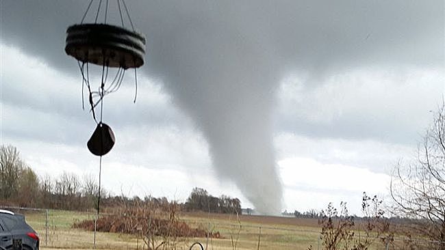
•Tornadoes sweep through the South of Mississippi this week, as two tornadoes were confirmed yesterday in Rose Hill and Lauderdale County: January 3rd. No injuries were reported, although power lines were knocked out; along with heavily damaged mobile homes. Further tornado watches are continuing in Mississippi.
•Mississippi River currently reached its flood stage over the weekend, and is expecting to rise. The river measured at 48.9 ft, shutting down Carthage Point Road. At 50 ft, the water will expect to rise onto Silver Street. The river will continue to rise to 60 ft by January 17th.
•Western Mississippi – Floods expected for the Mississippi River near Greenville. Flood stages are at 49 ft and will continue to near 60 ft until January 13th. Power will continue to be out in various areas, along with buildings becoming flooded.
•Eastern Mississippi – Conditions are mostly cloudy for the week. Showers are likely, with chances of thunderstorms.
•As for the Northeast, the snowstorms are affecting the south, expecting freezing, arctic air to hit southern parts of the country.
•Weather conditions are currently affecting I-95 travel, but should be improving.


Comments by Direct Connect Auto Transport