Expect Severe Spring Weather for this week, with warmer Spring-like temperatures for the Northeastern states toward the end of the week.
Photo Credit: Weather.com
North – From Pennsylvania to Connecticut, there will be slippery road conditions from snow showers tonight. Winter will finally start to come to an end as warm temperatures for Spring will approach toward the end of this week. From Indiana to New Hampshire, prepare for more Spring-like weather along with clearer driving conditions. The end of the week in these areas will be a great opportunity to transport your vehicle.
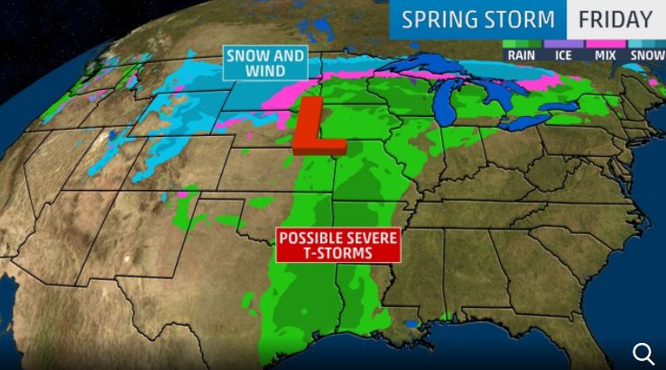
South – Warm air coming from the Gulf of Mexico mixed with cooler air will create severe weather from Texas to South Dakota from Friday to Saturday. This 1,000 mile stretch of land that will be affected will experience rain, high winds, severe thunderstorms and a chance for tornadoes.
Midwest – The low pressure system will come from the west to the Ohio Valley and deliver severe thunderstorms and rain on Saturday. A snow mixture is also likely for the Northern Plains and Great Lakes. From Wisconsin to North Dakota, you can see a mixture of snow and rain on Saturday.
West – A jet stream will bring warm, moist air from the West coast and Rockies and will travel East from Wednesday – Thursday. The low pressure system will bring snow to mountainous areas like California, Utah and Nevada. Areas that will especially be affected are the Northern Rockies, Sierra Nevada, Utah’s Wasatch, The Mountain West and the Cascades. There will also be snow in the Plains in parts of Montana to Wyoming.


Comments by John Costelac